
Web and desktop solutions tailored to your operational needs.

Expertise in GeoServer, PostGIS, QGIS, OpenLayers...

3D modeling, remote sensing processing, artificial intelligence.

Technical support, knowledge transfer, and custom training programs.
EGEOS Technology (formerly R&SD Technology) is an innovative company specializing in Geographic Information Systems (GIS), artificial intelligence applied to spatial data, and the development of robust and sustainable software.
EGEOS Technology combines advanced expertise in Geographic Information Systems (GIS) and Artificial Intelligence to deliver high-performance, interoperable solutions tailored to real-world challenges. The company stands out through its strong software quality culture, deep client commitment, and responsiveness to both technical and operational needs.

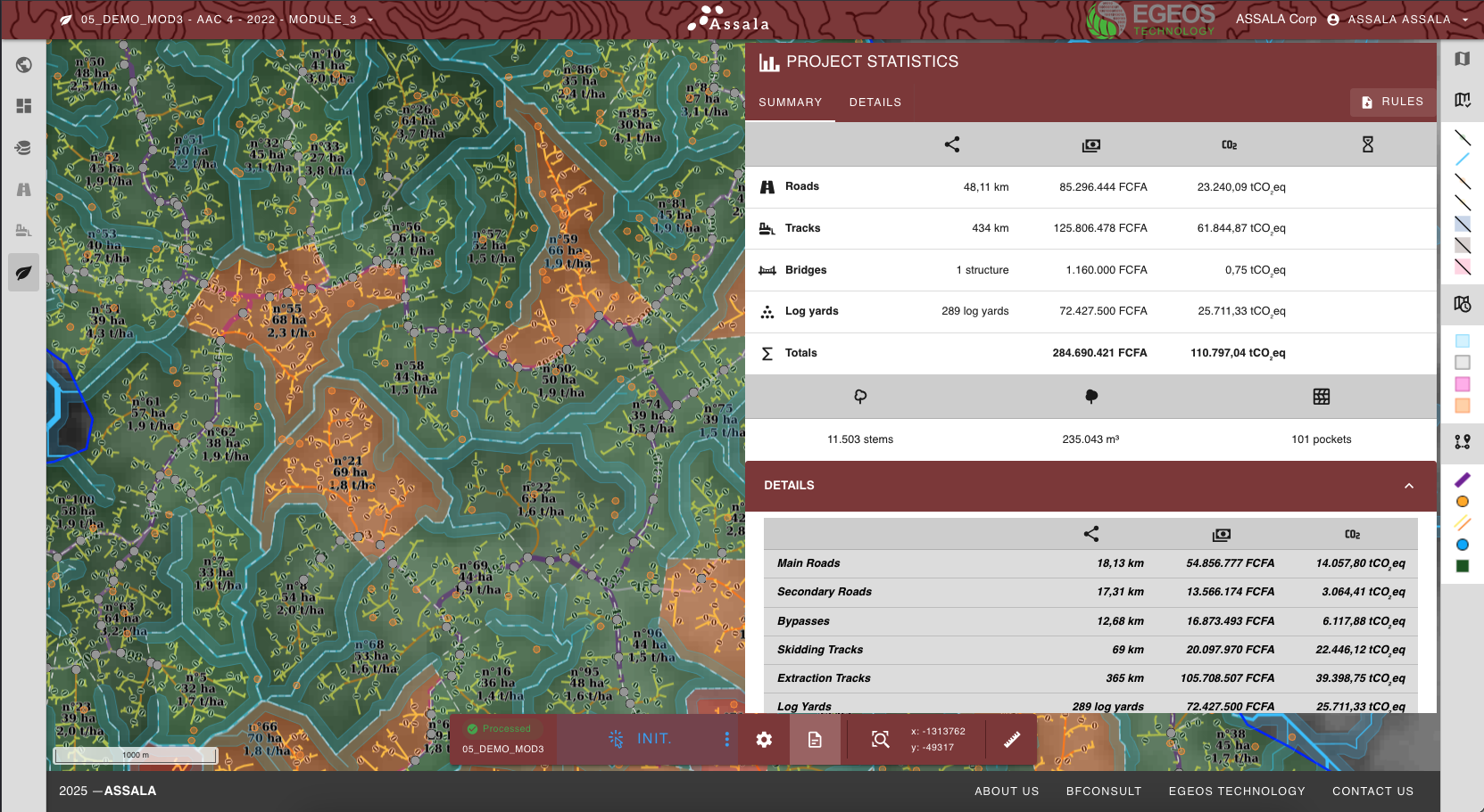
ASSALA is a digital platform that brings intelligence and efficiency to sustainable forest operations. Initially developed to optimize road planning and reduce environmental impact in logging activities, ASSALA uses spatial data and decision-support tools to help forestry companies make smarter, greener, and more cost-effective decisions in the field.
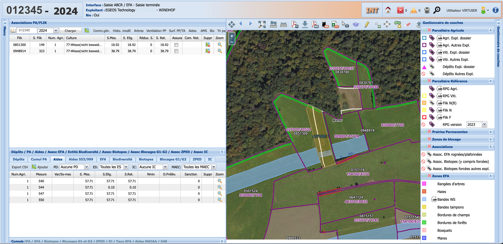
WebGIS Application for the management of agricultural land parcels for the Government of the Grand-Duchy of Luxembourg. This application is part of the « Integrated administration and control system (IACS) », which enables the monitoring and efficiency of the support granted to farmers by the EU, under the Common Agricultural Policy (CAP).
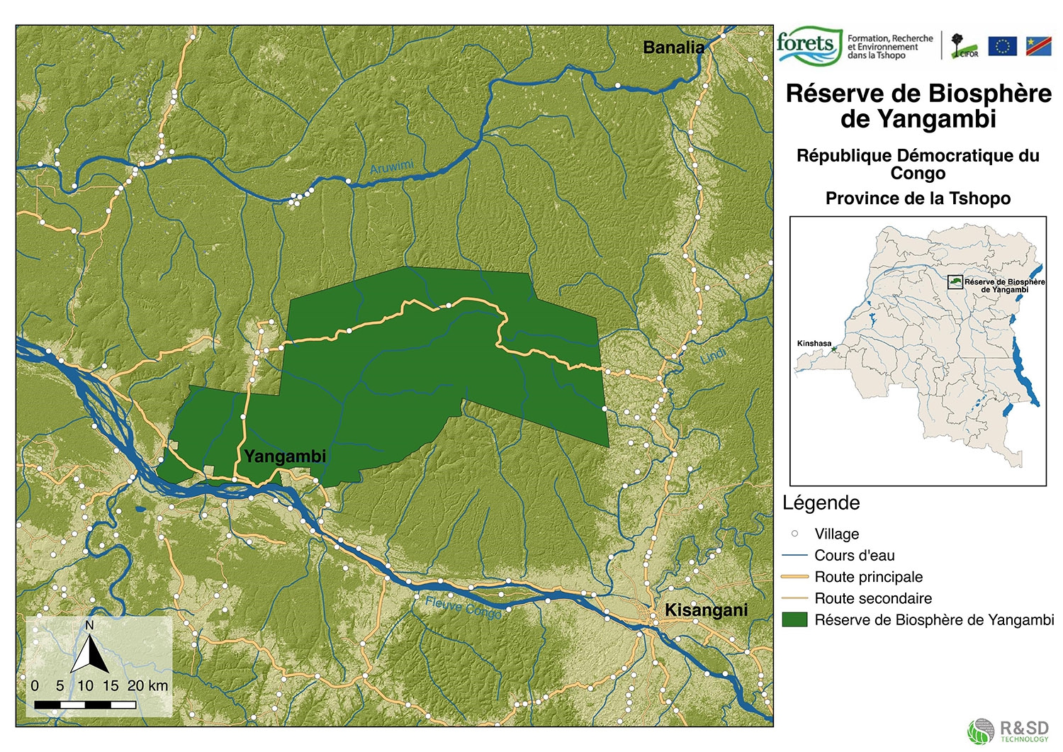
Consultancy missions for the provision of IT, GIS and Internet services for the University of Kisangani, Democratic Republic of Congo. This included drone-based orthophotographic mapping operated directly by our team, the development of a WebGIS platform to monitor project KPIs, and advanced Land Use / Land Cover (LULC) analysis over the target area.
LEO4CAP (Luxembourg Earth Observatory for CAP) is based on the Sen4CAP system and custom modules. It delivers CAP-specific monitoring products derived from Copernicus data (Sentinel-1/2). We are responsible for the installation, maintenance, and support of LEO4CAP instances within the national IT infrastructure (CTIE). We also manage on-demand product generation for the Ministry of Agriculture, supporting the operational use of Earth Observation in Luxembourg.
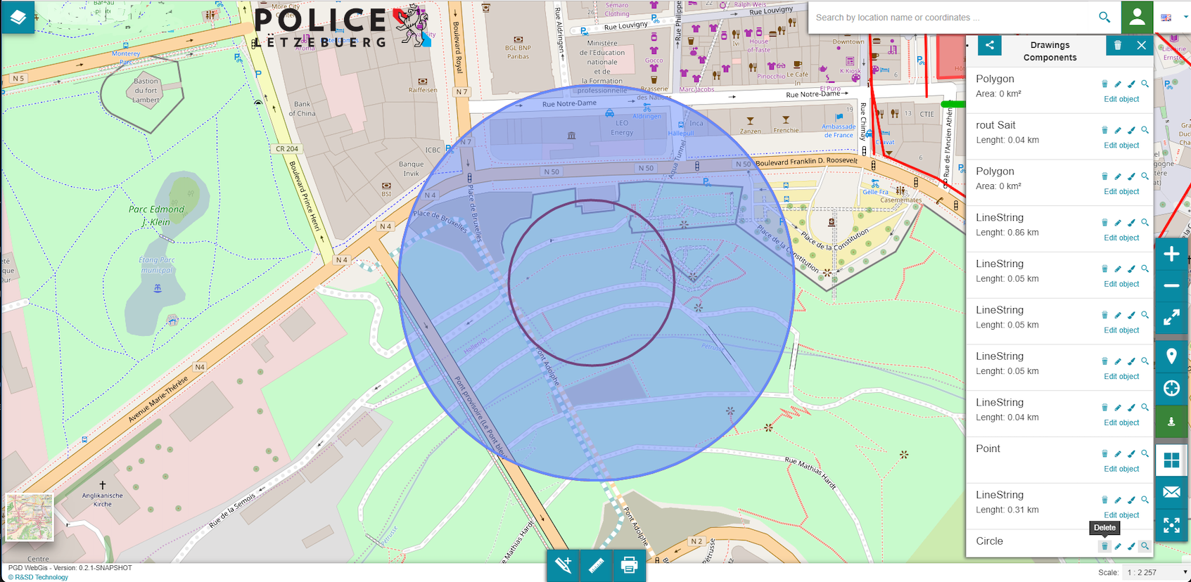
PGDGIS is a WebGIS platform developed for the Grand-Ducal Police of Luxembourg, enabling secure access, sharing, and annotation of spatial data. Built entirely by EGEOS Technology using open-source technologies, the system integrates police geodata with the national geoportal and supports Street View visualization, as well as real-time tracking of patrol vehicles and officers. The solution is deployed within the Police’s internal IT infrastructure.